|
travel@pangolin.liNamibia 2003
|
 |
 |
www.pangolin.li
home Travel
directory Travel
directory Namibia 2003
Main
Part 1 Etosha
Part 1a
Animals Part 2
Otjitotongwe Part 3 Highlands Part 4 Van Zyl's
P. Part 5 Marienfluss Part 6 Kaokoveld
Part 7 Damaraland Part 8
Twyfelfontein Part 9 Namib Part 10 Wolwedans Part 11 Gamsberg Panorama pics Namibia '03 Gallery
Namibia 2003
Main
Part 1 Etosha
Part 1a
Animals Part 2
Otjitotongwe Part 3 Highlands Part 4 Van Zyl's
P. Part 5 Marienfluss Part 6 Kaokoveld
Part 7 Damaraland Part 8
Twyfelfontein Part 9 Namib Part 10 Wolwedans Part 11 Gamsberg Panorama pics Namibia '03 Gallery |
|
contact last updated: 30-Jul-2005 Text/pictures subject to copyright by pangolin.li |
 |

 |
||||||||||||||||||
Part 3 - Opuwo, Upper Hoarusib and Himba's landTravel DetailsFrom Otjitotongwe we drove the road towards Opuwo on C35 via Kamanjab, Hobatere. 143 km from Otjitotongwe we turned left on DR3706 and reached Opuwo via Otjondeka, Otjirunda after 90 km. From Opuwo we set out towards Van Zyl's Pass, on the DR3703 to Otjitanda (139 km), which can be considered the start of Van Zyl's Pass.On our trip in 2005, we took the route from the Western corner of Etosha through Khowarib Gorge to Sesfontein, from where you can follow the alternative road to Opuwo. Go directly to Opuwo and OpuwoCamp or OpuwoCamp to Van Zyl's Pass. The road to Opuwo
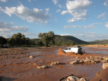
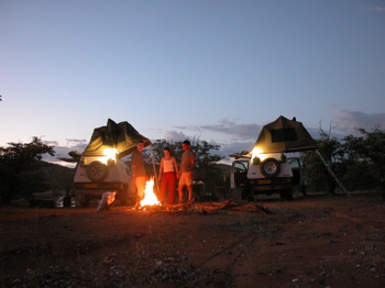
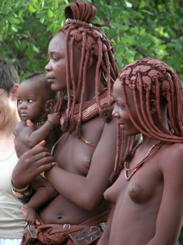
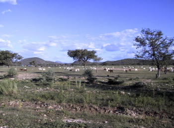
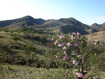
Opuwo and Opuwo CampOpuwo was to be the last possibility to refuel and shop for ca. 1000 km (Sesfontein). So we did. There are several smaller shops (a bakery was closed) and one supermarket in Opuwo. Each magazine about the region boasts a picture of the latter, with Himba women in traditional attire shopping there. Being a melting pot of the various people, Opuwo felt a bit depressing to me: elderly drunken people, workless men, Himba women trying to sell everything from family heirlooms to tourist curios - but there was also a highly interesting football match going on. Football and music unite the cultures.So we put our kilometer counter to zero while filling both fuel tanks to the rim, left Opuwo behind us soon, and drove westwards along the Steilrand mountains. The first obstacle - or better: adventure - came after ca. 35 km in the form of the upper Hoarusib river which had swollen and was flowing over our path. We did cross it at a ford a little bit to the North, but only after wading it and carefully preparing the cars for their first adventure. The little pass that followed at km 40 was no longer special. However, with dawn coming closer, we started looking for a camp site, and found an appropriate spot not far from the road. Time to build camp for the first time in the wilderness - "Opuwo Camp"! We went to bed early after our braai, having no lights other than gas lamps and stars.
Top of page Opuwo Camp to Van Zyl's Pass
Top of page Go to:
|
||||||||||||||||||
 |